Prefecture flag
Main City: Nagoya


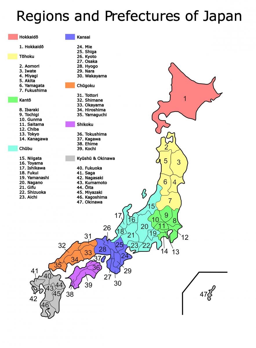
 Japan is divided into 9 regions, which are split into 47 smaller prefectures. Those regions are not formally specified; they do not have elected officials nor are they corporate bodies. However, the practice of ordering prefectures based on their geographic region is traditional. They are numbered based on their location from north to south.
The following pages contain a presentation for each prefecture providing a general overview about their economy (local industries specialisation, opportunities, available incentives and support for EU companies...), advancement of local research and science, local culture, geography, landscape and environment.
The NHK made some videos presenting the 47 Prefectures of Japan they are available here (click on the "more" icon at the bottom of the page, just under the small map of Japan).
The main advantage of this region is its natural environment, allowing the area to have the highest levels of production in agriculture and fisheries.
Tohoku region is specialized in the electrical machinery and food industry sectors. Among Tohoku’s trading partners, Asia and North America are in top positions.
Kanto region functions as Japan’s greatest launch-pad for new businesses and industries, and with Tokyo located in it, the region can be considered Japan's engine.
Chubu region accounts for 20% of the nationwide share in shipments of manufactured goods and is a catalyst driving the Japanese economy with its manufacturing base.
The Kansai region in Japan is located in the heart of Japan. Including the three major cities of Kyoto, Osaka and Kobe, the Kansai region has the nation’s second-largest economy, with a population of over 20 million.
The Chugoku Region includes research and development businesses in the fields of electronics, biotechnology, and new materials, and is leading the world with its advanced technical power.
Agriculture industries are well developed in the region and provide a gross domestic product that is higher than the average when compared to other areas of Japan.
Thanks to their location, both Kyushu and Okinawa are strategic regions for Japan to connect with nearby Korea, China and the whole East Asia region in general.
Picture: Map of 1600's Feudal Japan
Picture copyrights: public domain

Prefecture flag
Main City: Nagoya

Prefecture flag
Main City: Akita

Prefecture flag
Main City: Aomori

Prefecture flag
Although the Chubu area only comprises about 10% of the national area in geographical terms, it accounts for 20% of the nationwide share in shipments of manufactured goods and is a catalyst driving Japanese economy with its manufacturing base.
The Chugoku Region is located in the western part of Japan. It borders the regions of Kyushu, Shikoku and Kansai, making it a transportation hub for all of western Japan.

Prefecture flag
Main City: Fukui

Prefecture flag

Prefecture flag

Prefecture flag
Main City: Gifu

Prefecture flag

Prefecture flag
Hokkaido is unique in that it is considered both as a region and as a prefecture due to its size and localisation.

Prefecture flag

Prefecture flag

Prefecture flag

Prefecture flag

Prefecture flag
Main City: Morioka
The EU-Japan Centre currently produces 5 newsletters :


